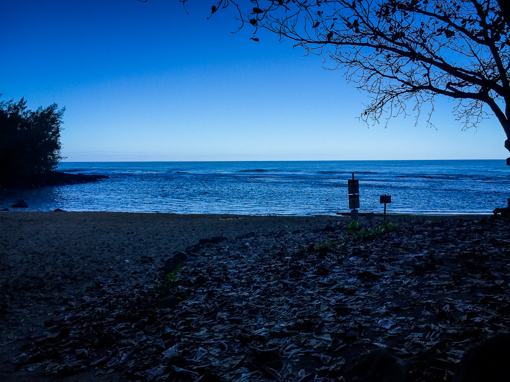
Visited February 2016
Hawaii, at a surprise to no one, has one of the most developed tourist economies in the world. The islands draw tourists to their perfect beaches and then tour companies, hoping to hustle more tourist dollars, advertise their services everywhere.
On our first day in Waikiki, we were met on the sidewalks by men waving boards and flyering, hoping to catch the fancy of tourists like us. Everywhere you looked, you saw advertisements for hop-on/hop-off busses, island tours, driven tours, boat tours, driven-boat tours, helicopter tours, food tours, inter-island tours, surfing lessons, snorkeling, diving, whale watching, luaus, military attractions, volcanic attractions, cosmic attractions, waterfall attractions, agricultural attractions, and every type of "cultural show" you can find, ranging from an "authentic" look at the original Hawaiian peoples to Elvis Presley's time in Hawaii.
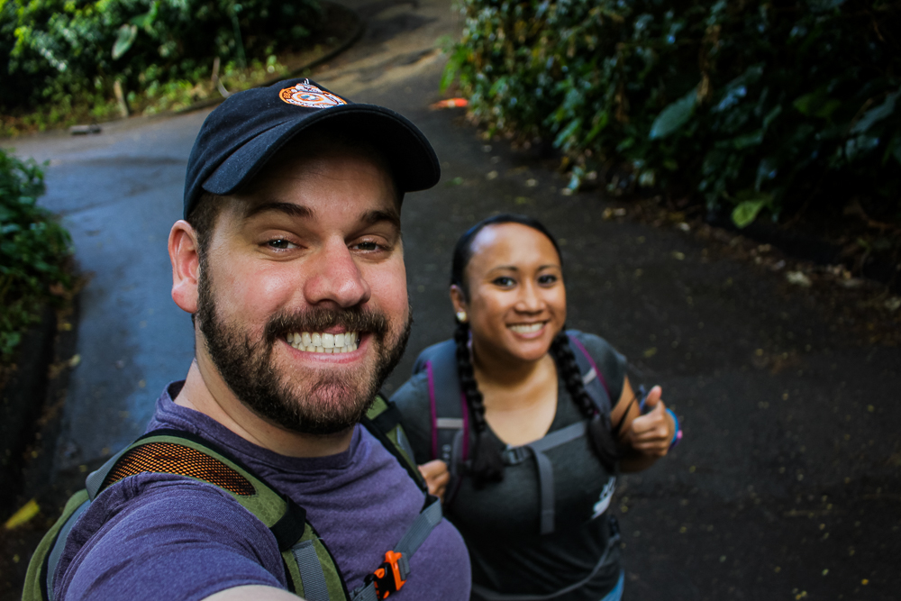
But for the cost of getting to Hawaii and holing up in a hotel, I wasn't particularly keen on bleeding out more of my hard-earned dollars. Luckily for me, there's a really cheap way to experience a new destination—hiking. Hiking is an attraction in and of itself, allowing one to gain the most unique vantage-points of an area and connect with locals, all at the same time. Cindy and I would embark on three different hikes while in Hawaii, all in different environments, with different lengths, and different levels of difficulty.
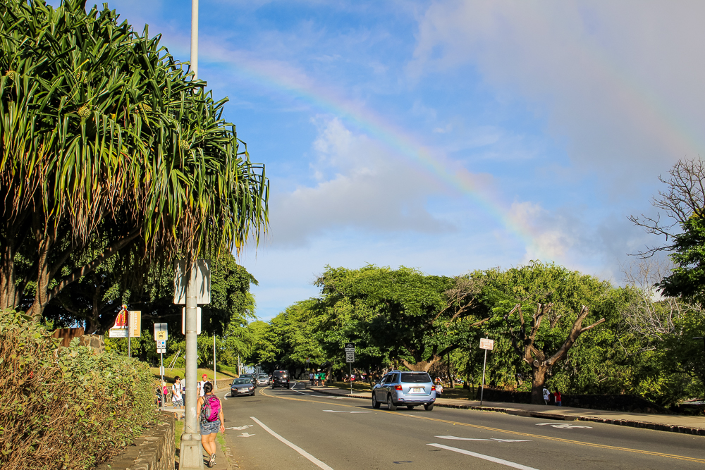
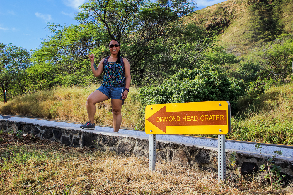
The first hike we enjoyed was the trek up Diamond Head, the volcanic cone just adjacent to Waikiki. Jutting dramatically out from behind the skyscrapers, Diamond Head once served as a military base and is full of pillboxes and the remains of gun turrets, once stationed to protect the neighboring harbor. We left our hotel early and intended to call an Uber to take us to the Diamond Head trailhead. We couldn't find one available so early in the morning and instead followed Google's suggestion to take The Bus, the main form of public transportation on Oahu. Boy I'm glad we did! It was clean, easy, and cost only a fraction of that of an Uber. We made it directly from our hotel to Diamond Head in 12 minutes.
And yes, we were totally greeted by a rainbow when we arrived!


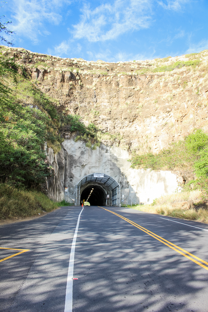
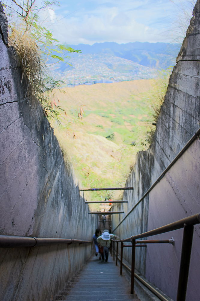
Once there, we learned that there is an extra 15 minutes of walking needed to get from the bus stop to the entrance of the Monument. The trek is all uphill, except for a tunnel through the crater wall with barely any room for pedestrian access. Still, the trek afforded some pretty awesome views of the eastern half of the island.
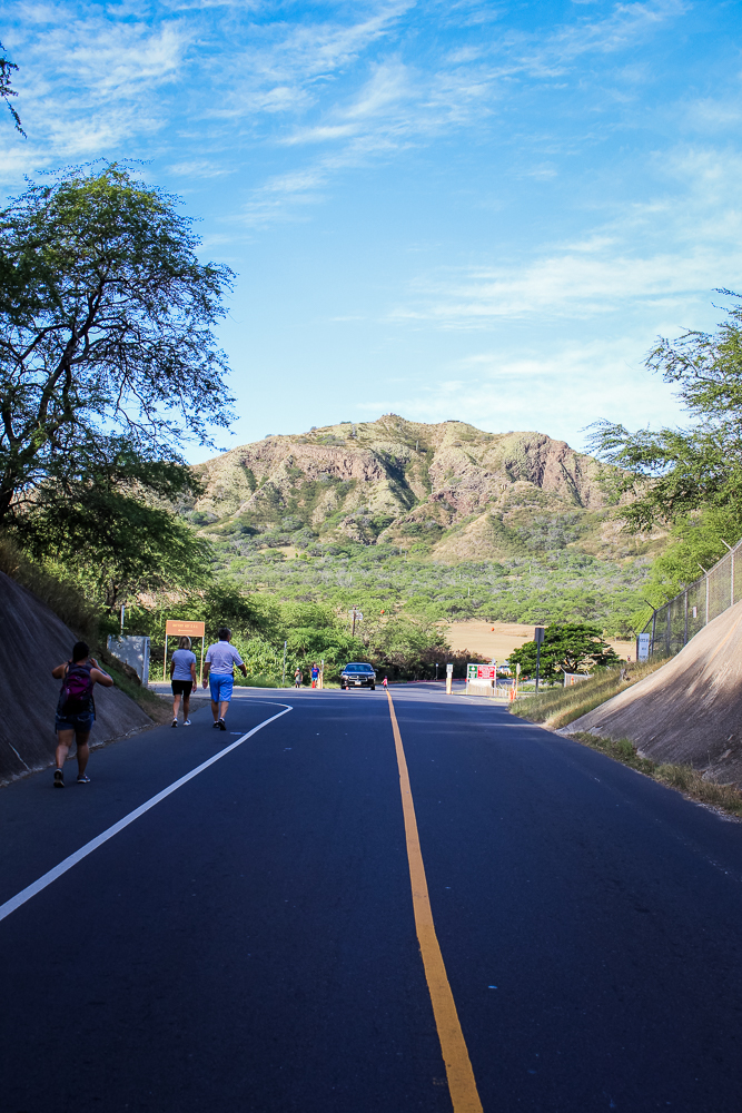
Once through the crater-wall, you emerge on the other side in a serene, grassy meadow of sorts. It cost one dollar a person to enter, likely the best $2 I spent while in Hawaii. After a picnic area and pop-up gift shop, a trailhead invites all hikers. The trail begins as a paved, park-side path before turning into a dirt trail, etched into the canyon-side and growing in elevation.


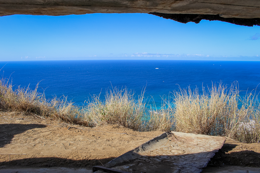
About half way up, the canyon wall breaks and you get an amazing vista over the crater floor and ocean beyond. We used an old equipment hoist to snag a couple photos without other tourists. The view was amazing!


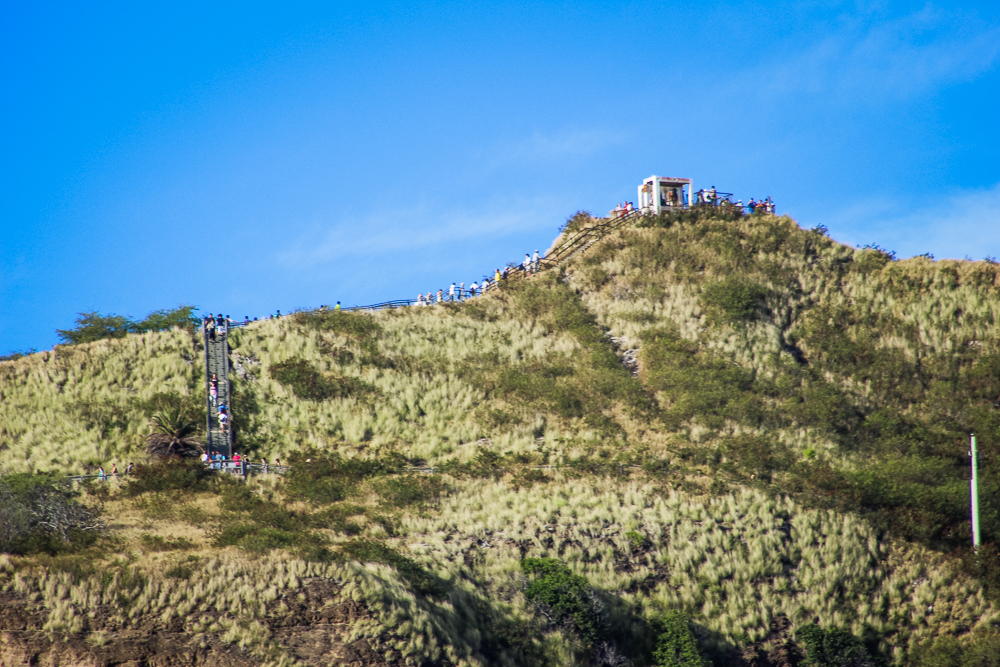
It's also at this point in the hike that the path ceases to feel like a regular trail; a short walk up from the hoist and you enter the "military base" portion of Diamond Head. A staircase takes you to a tunnel, straight into the mountain. You emerge from the other side, proud of how well you managed the elevation gain, only to see an even longer staircase. Lame!
Soon enough though, you make it up the final step and see the most beautiful blue line, glowing from outside of the gun turret you've arrived at. We made it!


It is here where the steady stream of tourists seem to coalesce, like peeps on an incomplete pathway in Roller Coaster Tycoon. Despite the crowd, we were happy to squeeze our way onto the peak and jostle for a position to take photos from.


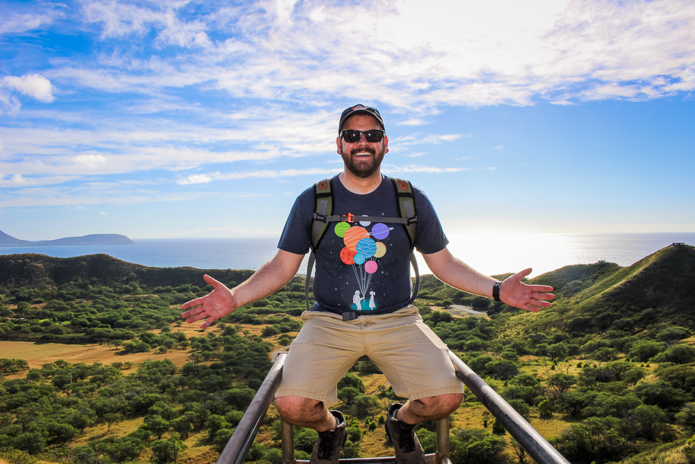
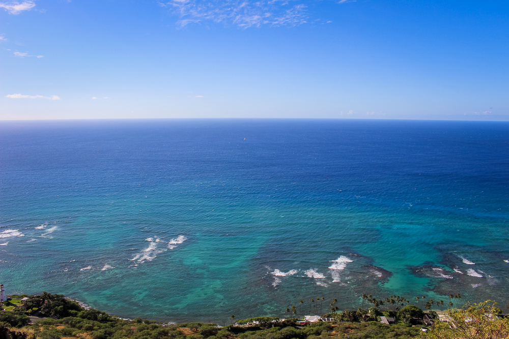
Finally at the top, we were greeted by an amazing view of Oahu. From this vantage point, we could see a good 30% of the island! The view stretched from the sunny, eastern shores to the central, lush-green valleys, and reached beyond to the tan, western-side of the island. The entire vista appeared to be anchored around the turquoise water of Waikiki.


This is one of the reasons I love hiking! Sure, it's a workout! (And trust me, I hate to workout!) But after all of your hard work, you have a beautiful view as a little reward to celebrate your effort!
After getting our photos, we zipped back down the mountain. This leg went much more quickly than our trip up. We were approaching the middle of the day and were pretty hungry, so we grabbed a hot dog from a food truck in the parking lot. We would use The Bus to return to Waikiki and explore more.
Two days later, we would have another tool for exploration: a rental car. While we primarily rented it to explore the north shore, we ended up keeping the vehicle for one additional day and used it to get to the harder-to-reach areas of Honolulu. Though accessible via public transportation or through tour companies, the car would prove the easiest way to get to our next hike: Manoa Falls.
The drive to Manoa Falls took us from Waikiki, to a suburb of Honolulu, and then into a small, forested valley where we parked at the Manoa Falls trailhead. In just 30 minutes time, we went from our hotel in urban Waikiki to smack in the middle of a dense rainforest.


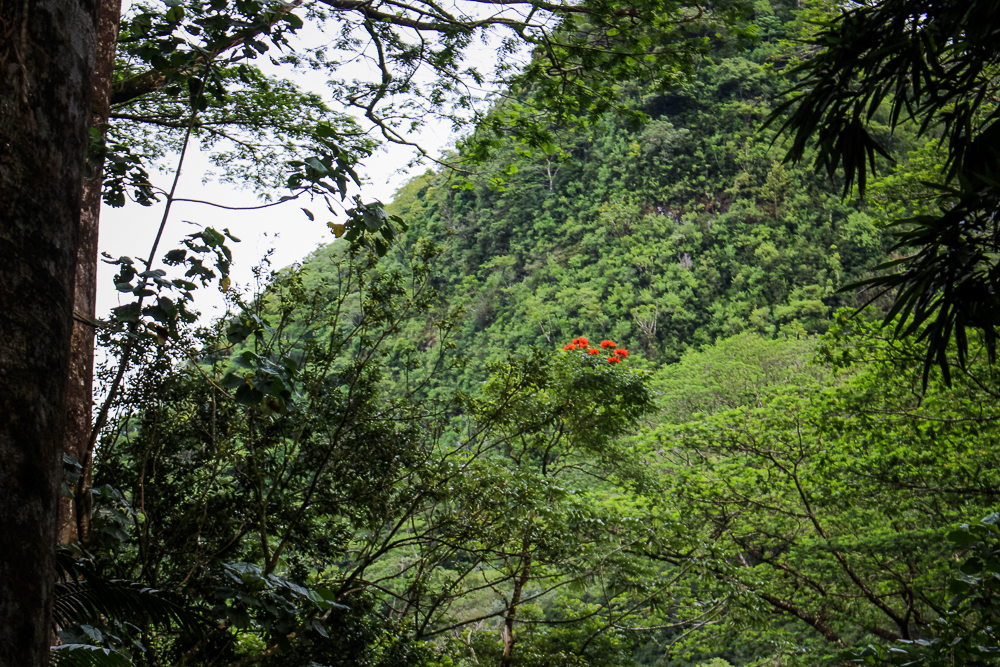
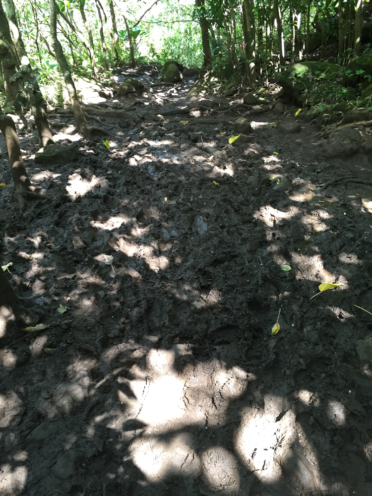
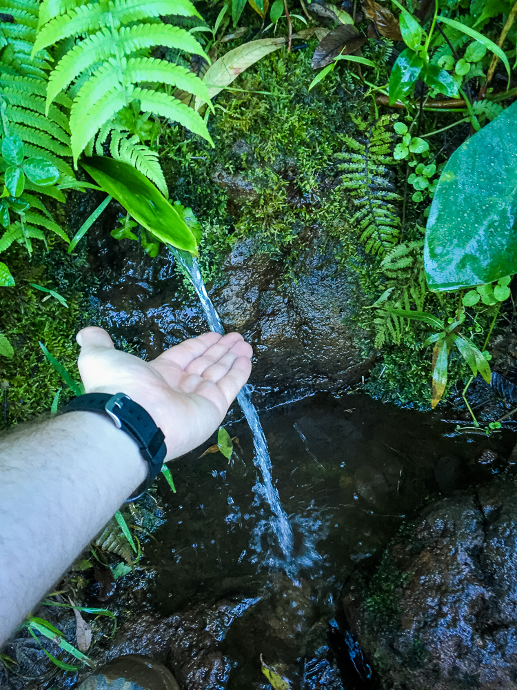
Seriously! I was blown away by just how tropical and forested the area was! This hike would be one of the greenest hikes I've ever had the pleasure of navigating. Everywhere your looked was a dense web of vines, trunks, bamboo, ferns, and an occasional pop of red or purple wildflowers. The vegetation was fed by the creeks and the dew and was cemented together by the thick mud covering the valley floor.


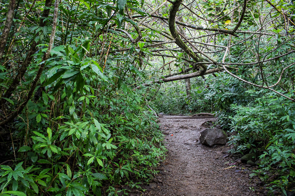
Weaving in and out of the canopy, the trail is well established and occasionally has stairs or carpeted boards to help hikers up the valley. After about 40 minutes of hiking, we arrived at the trail's terminus: Manoa Falls, a 150 foot waterfall carving out the very area we just hiked through. We had made good time, passing a few tour groups on the way, and tried to take advantage of the vista before too many others crowded the view.


After a few photos and some water, it was time to head back down the valley. We saw others depart for more ambitious side hikes but we had other places to see!


Back at our vehicle, we would continue to other Honoulu area attractions before returning our rental car. 36 hours later, we would be on a plane and in route for the final island of our journey, Kauai.
Our last hike in Hawaii would be our greatest.
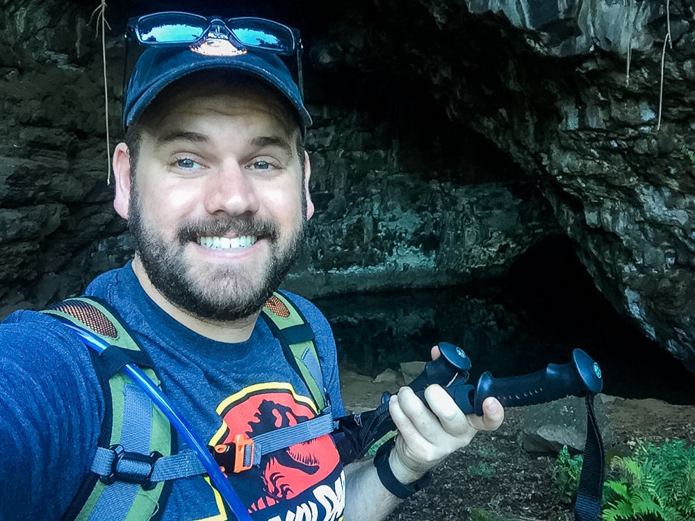
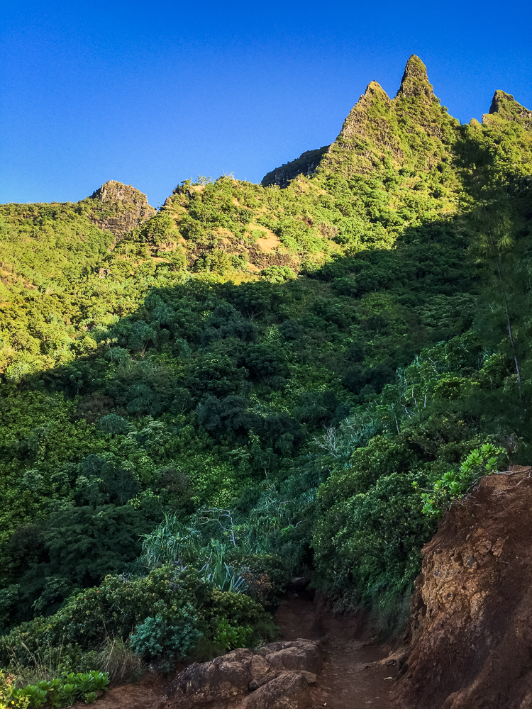
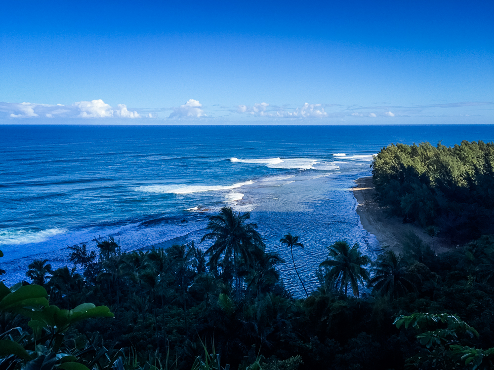
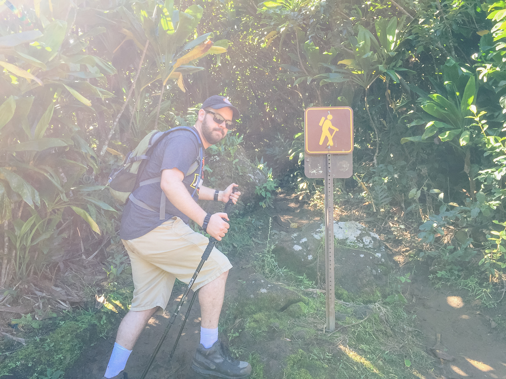
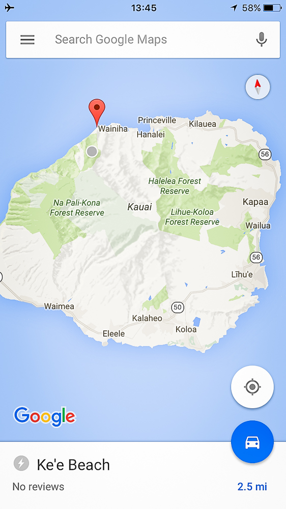
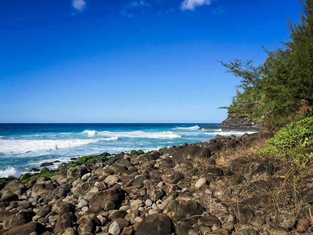
On Kauai, we knew that we wanted to take advantage of one of the most famous and beautiful of all Hawaiian hikes, the Kalalau Trail along the Nā Pali Coast. The Nā Pali Coast is the rugged northern stretch of Kauai, full of cliffs and valleys that jut straight out of the ocean. The shore is used in many movies, most famously inspiring the helicopter arrival scene in Jurassic Park (although the iconic waterfall landing scene was shot elsewhere on Kauai). This north-western edge of Kauai is completely inaccessible to vehicles and can only be reached by boat, helicopter, or on foot via the Kalalau Trail. So we're talking a pretty remote area here.
The Kalalau Trail penetrates 11 miles into this coast, starting at Kee Beach and weaving up and down the coastal valleys until concluding at Kalalau Beach. A permit is required to hike the entire trail and it is advised to complete the trail in a few days and camp at Kalalau. This route is considered one of the most dangerous in the world. Despite this, the first two miles to Hanakāpī'ai Beach is a popular day-hike, complete with a side-trek to Hanakāpī'ai Falls. Cindy and I came prepared for some-version of this day hike and were ready to dedicate the whole day to it. We drove from our hotel on the southern-side of the island to the remote Kee Beach in the north. The road thins near the end and there are several "one lane" bridge crossings, where drivers are required to yield to oncoming traffic. We parked 10 minutes down the road.
Unfortunately, I realized when we arrived at the trailhead that I left the battery for my camera at the hotel, 75 minutes away. After a few choice curse words to make me feel better, I resigned and simply used my cell phone camera to chronicle our journey. We passed some farms, caves, and arrived at Kee Beach on foot.


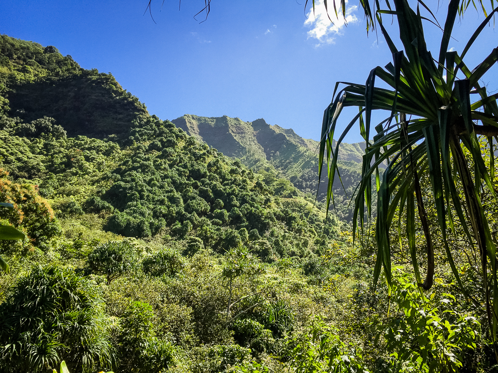
After a quick bathroom break and inventory check of our water and food, we were finally ready to leave. All of the warning signage at the trailhead only added to the mystery of what we were about to embark on. We clipped our backpacks tightly and set off uphill. The trail travelled up and up, with the view of Kee Beach improving with every step. Finally at the 1/2 mile mark, we surpassed the lip of the first ridge and got our first, great view of the Nā Pali Coast.


This view was as good as any a view that would be accomplished on this hike! Feeling good and ready for more, we continued up and down the valley walls for another 1 1/2 miles before reaching the Hanakāpī'ai Stream.


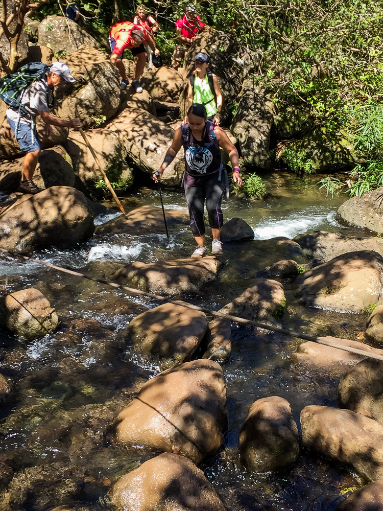
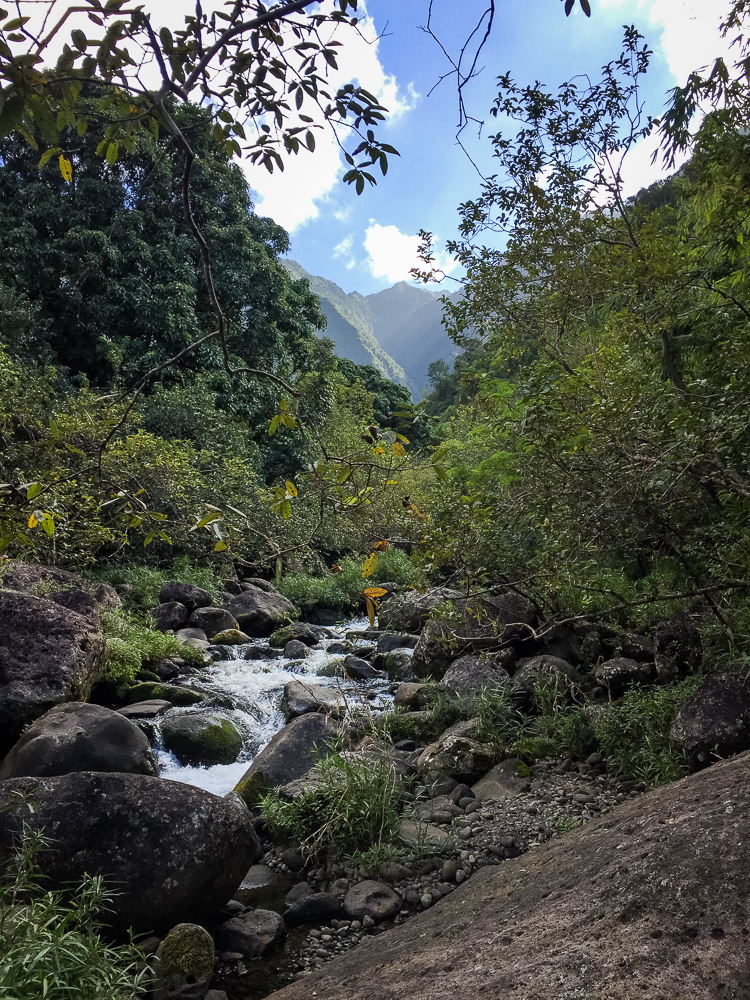
The Hanakāpī'ai Stream crossing was pretty dangerous! The rocks were slick and there was a small queue of hikers waiting to cross so folks felt rushed. I saw several people slip into the stream. Feeling cocky, I took out my phone to snap photos of the stream and ended up loosing my balance. Into the drink I went!
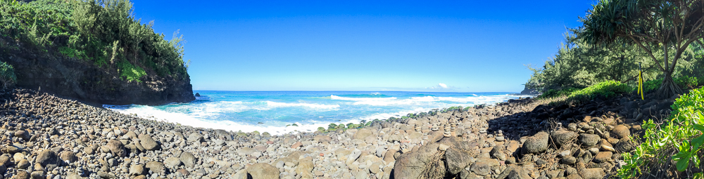
Luckily, I stayed standing and the water didn't make it past my knees. Even more luckily, my phone stayed in hand. I pulled myself out and we continued onto Hanakāpī'ai Beach. All of the arial images I saw of the beach made it look like a proper sandy beach but unfortunately, it was quite rugged and rocky. Signage warned of approaching the ocean, where strong tides smashed against the rocky sea-floor with intensity. Apparently over 80 people have died at the beach. We chose to stay back and snack, instead.

After resting for a bit, we took stock of our water supply and debated on whether or not we should continue to Hanakāpī'ai Falls. We were only 2 miles in and already a bit tired, but we were in tremendously good spirits. I was excited for more but worried about the fact that, for every step further, we would only add to our return journey. The side-hike to Hanakāpī'ai Falls is the difference between a 4-mile hike and an 8-mile hike. In a momentary burst of confidence, we ended up saying, "what the hell!" and went for it.

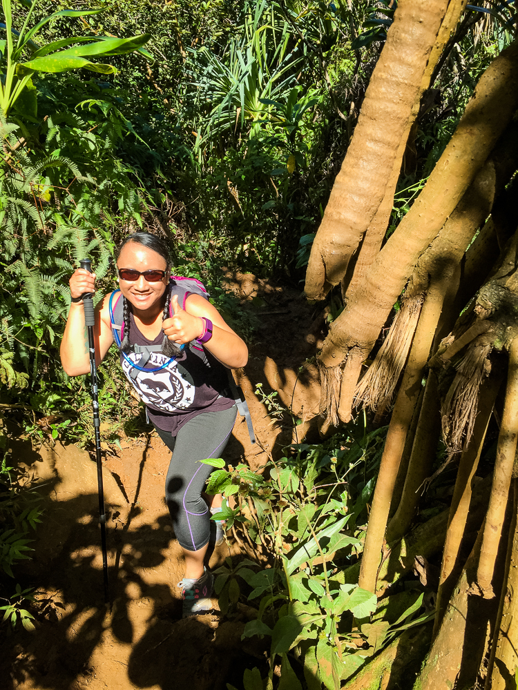
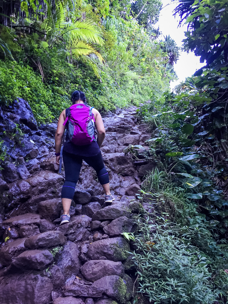
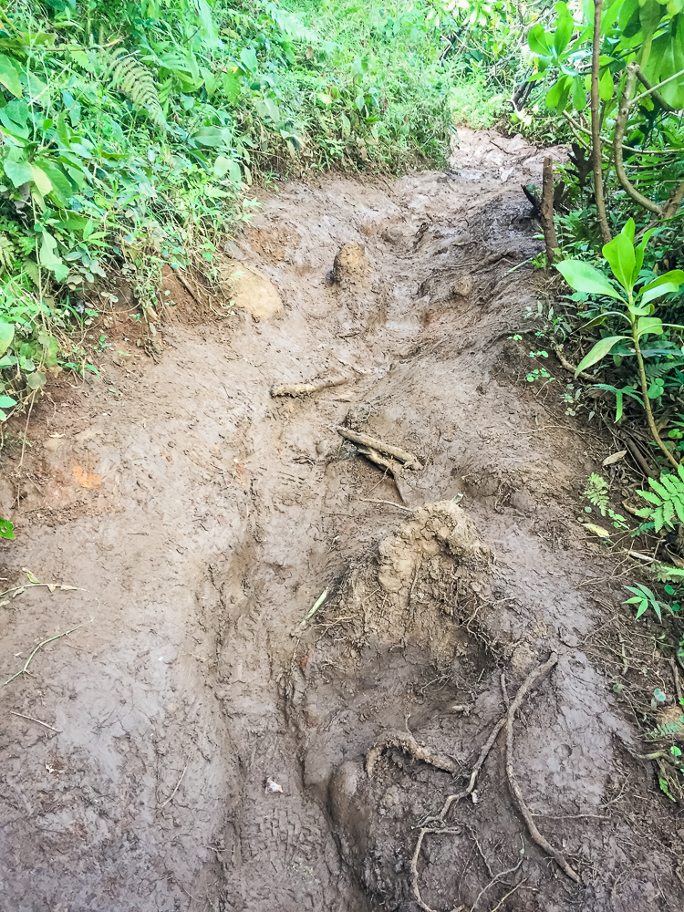
It didn't take long to realize that the trail had instantly worsened. It was far less well-maintained (as in, it wasn't maintained); the uphill trek was full of a thick mud that made every step a fight. There were also several stream crossings in places where the water was moving pretty quickly and the rocks were very slick. We encountered two people who had slipped on the rocks and were limping back down the trail for assistance. Seeing this warning, many folks opted to just walk through the hip-level water rather than chance the rocks. Luckily, we made it across safely.

Still, the journey was treacherous. The heat was beginning to take its toll and we knew we had to be careful about how much water we drank. At one point, 3 1/2 miles in, the hike became a scramble and we had to climb up slick rocks with our hands and feet. We oftentimes would pass hikers in the opposite direction at the moment where the trail was at its thinnest, beside a 30 foot drop. I was growing increasingly uncomfortable with the hike. We would often ask passers-by about how much further distance remained and would be told "just a little bit more!", every time!
"That's what the last person said!"
We were probably just about to call it quits when we saw the falls emerging from around the canyon-bend.

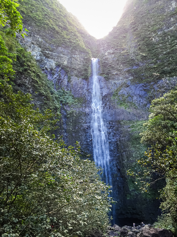
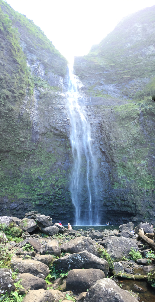
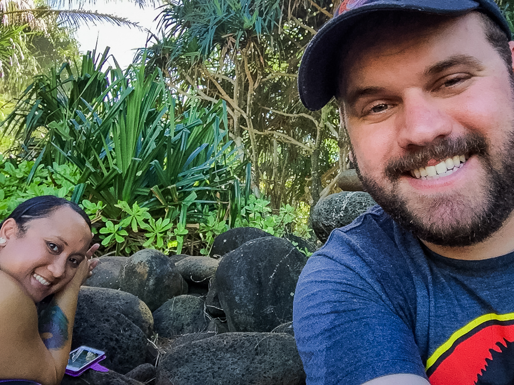
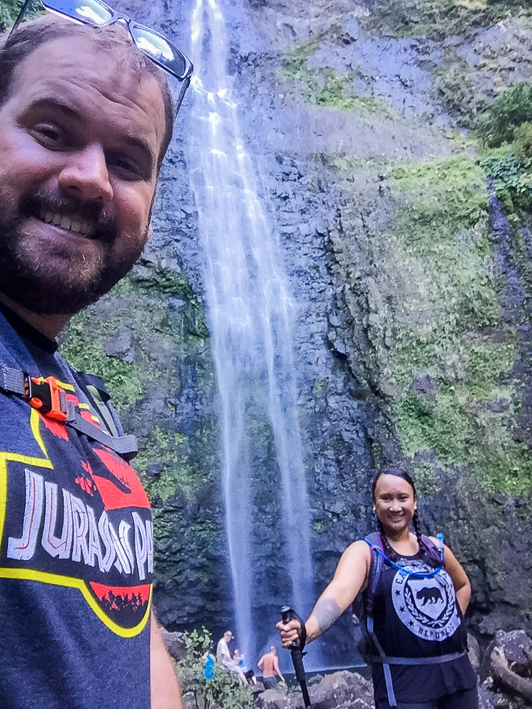
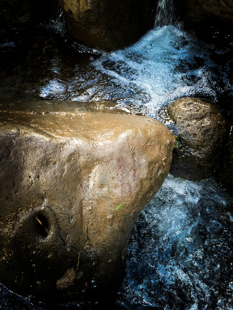
Finally, we made it! We arrived at Hanakāpī'ai Falls, a 300 foot vertical waterfall splashing down the valley wall. It was an impressive view and a welcomed finale to our uphill climb. We stopped to rest, ditched our shoes, and basked in the mist radiating off of the waterfall. It was nice to cool down.
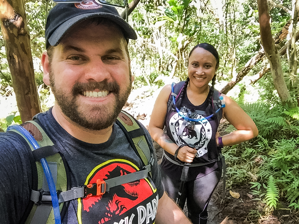
Several other hikers saw my "Jurassic Park" shirt and asked if this was the famous waterfall. I had to break the bad news that it wasn't. We watched others swim in the pool at the base of the falls but we were content sitting back and eating our Red Vines.


I've done long, difficult hikes before. Our 12-mile Tunnel Falls hike comes to mind as it is what I used to benchmark against this 8-mile hike. But this hike was different, in a bad kind of way. It was the most difficult hike I've ever embarked on. Still, as I pulled out my phone and looked at how far we had treked across the island, I couldn't help but feel proud of our accomplishment.
After about 15 minutes or so of resting, we knew it was time to go back. We didn't want to get too comfortable! And so, we embarked back down the hill. In places, the hike was easier than before whereas some of the down-hill rock scrambling was challenging. I gave Cindy one of my trekking poles so as to help her down the rocky terrain. Cindy now has her own trekking poles!
We made it across the difficult stream crossing, yet again. This time, we found the place that the previous passer-by fell and cracked his leg open! Beyond the creek, the trail continued to be difficult. Mud had eroded out the main, walk-able portion of the trail and we found ourselves having to improvise through the plants.

By the time we had made it back to Hanakāpī'ai Beach, there were much fewer people than before and the sun was on the completely other side of the sky. We took in our last rest. I found an easier way around the Hanakāpī'ai Stream and were soon on our way up the final 2-mile stretch of the hike.


Almost immediately after setting off, the moment I had feared arrived—I ran out of water. I typically drink too much, too fast, but was somewhat proud that I had actually made it this far on only 2 liters! Still, I was able to borrow a few sips from Cindy's pack and dipped my hat into the little streams we crossed, to keep my head cool.

By mile 7, Cindy and I were not talking. The goal was to conserve any energy we had remaining and get back to the car. The trail was empty, except for the occasional thru-hiker who was coming from Kalalau Beach, 10 miles away. Boy, there's no better reminder of how out-of-shape you are than when you get passed by someone who has been hiking for far longer than you!
When we came around the final corner and saw Kee Beach, our starting point, down below, we were too tired to celebrate. Both in pain and out of water, we simply wanted to get back to our car. The Kalalau Trail would have one final laugh at our expense as Cindy slipped and landed on her back, hard. I knew better than to make a remark about it. This one sucked.
And yet, as we turned the corner away from the Nā Pali Coast, I knew that I was immensely proud of what we had done. It was a hike that I will always remember for a view of Kauai that was always worth it.

Hiking in Hawaii was one of the most difficult and yet rewarding parts of our vacation. When we refer back to our time on the islands, our hikes resonate as one of the most memorable aspects of our stay. We were so challenged and satisfied, that we are trying to integrate hikes into all of our future travel plans. Views like that just cant be reached at ground-level.
For more photos from our three hikes through Hawaii, check out the gallery below!